If you’re looking to travel some of the trails and back roads you’ve read about on our site be sure to take along a map. Below you will find a collection of the maps we used during the planning and running of various trips. These maps are not new and are available on many sites around the Internet but we thought we would consolidate them into one location to help out.
| location | state | map |
| Ensenada to Cabo San Lucas | Baja Mexico | 2007 Baja Race Course GPS Zip File |
| Rubicon TOPO w/o trails use for general orientation | California | Rubicon Section 1 Rubicon Section 2 Rubicon Section 3RTF_Trail_Map-1 EDC_Trail_Map-1 |
| Naches Wagon Trail | Washington | Topo with history |
| Naches Pass Trail Lower West Side | Washington | NWJeepn.com map |
| Naches Pass Trail West Half | Washington | NWJeepn.com map |
| Naches Pass Trail East Half | Washington | NWJeepn.com map |
| Olympic Mts – Pacific | Washington | Forest Service map |
| Olympic Mts – Hood Canal | Washington | Forest Service map |
| Tahuya State Forest | Washington | Forest Service map |
| Tahuya State Forest | Washington | NWJeepn.com map |
| Reiter Trails | Washington | Jay Greening Topo map |
| Florence Dunes National Recreation Area. Spinreel to Horsfall area TOPO w/o trails use for general orientation | Oregon | Spinreel to Horsfall map 1 Spinreel to Horsfall map 2 Spinreel to Horsfall map 3 |
| Florence Dunes National Recreation Area. South Jetty to Siltcoos area TOPO w/o trails use for general orientation | Oregon | South Jetty to Siltcoos map 1 South Jetty to Siltcoos map 2 |
| Florence Dunes National Recreation Area. Umpqua area TOPO w/o trails use for general orientation | Oregon | Umpqua Dunes |
| Tillamook State Forest Off-Highway Vehicle | Oregon | Tillamook OHV Guide 2014 |
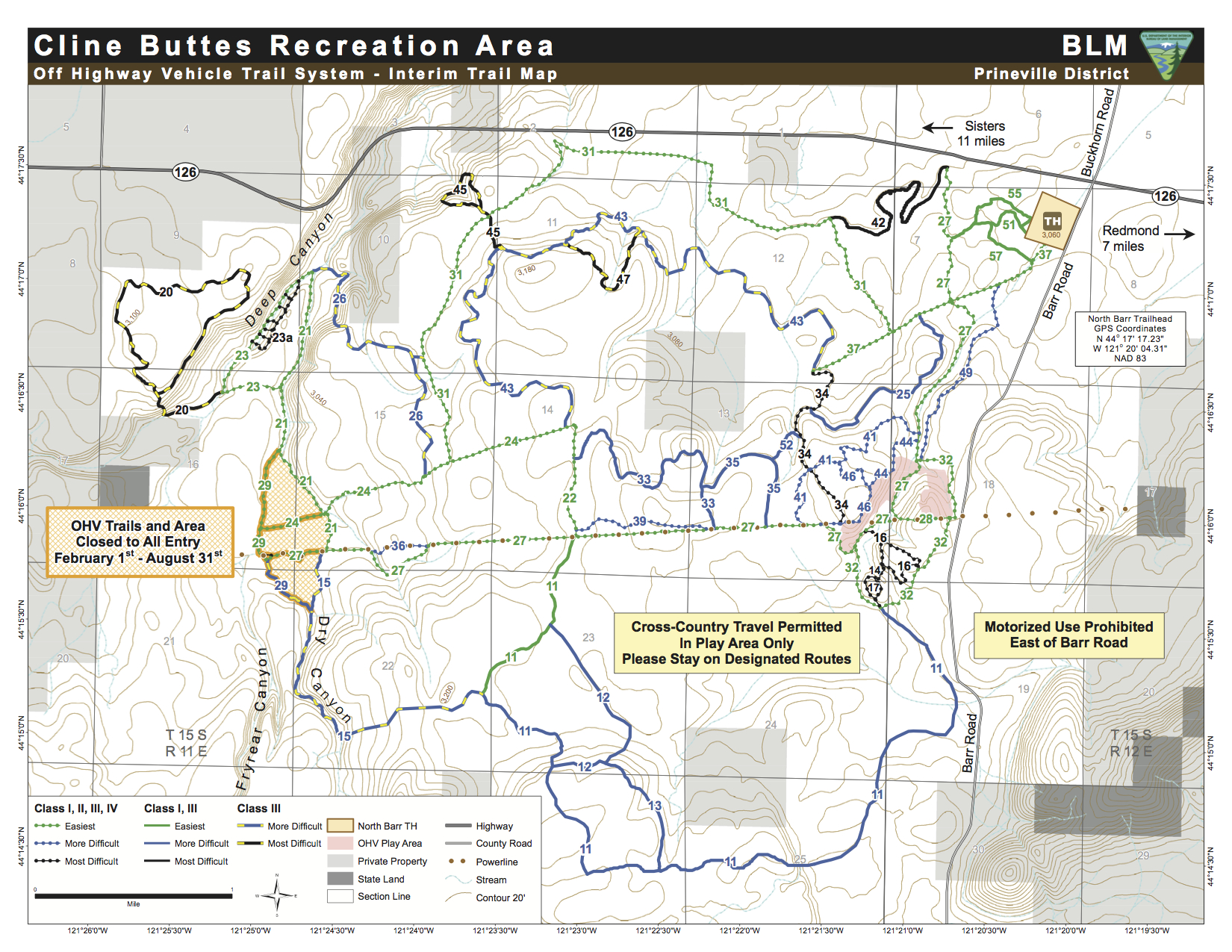
| Cline Buttes Recreation Area | Oregon | Cline Buttes recreation area usage map |
| Cline Buttes Recreation Area | Oregon | Cline Buttes Recreation Area Trails Map |
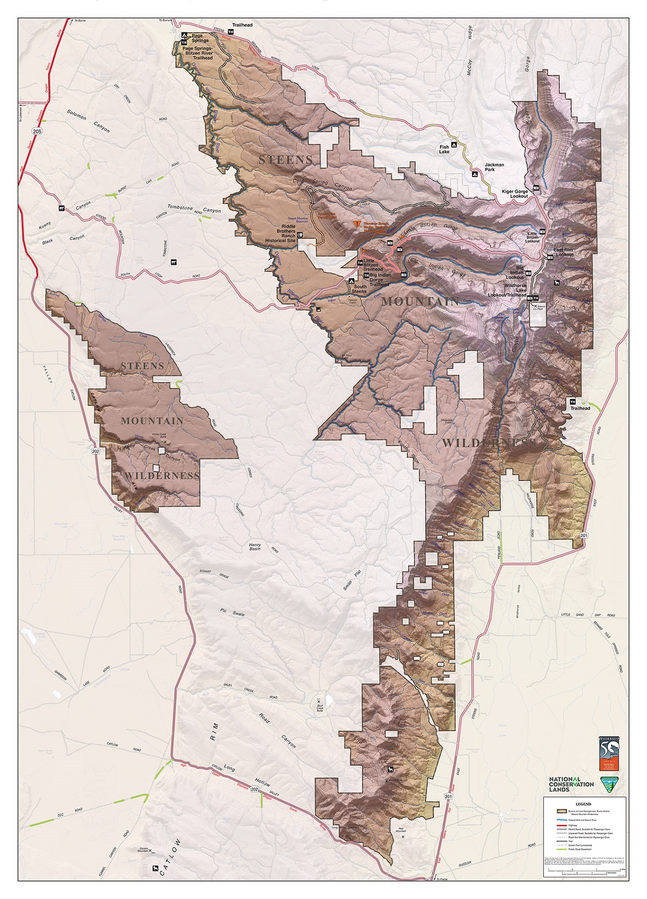
| Steens Mount Area | Oregon | Steens Mountain BLM Map |
Be sure to check back in order to see what new maps have been posted.