 2009 was incredible for off-road adventures… Tahuya OVR Park, Bill Burke training, Tillamook State Forest and of course the Rubicon Trail off-road adventure. It wasn’t so good for economic adventures. Without much work we had lots of time to hit the 4×4 trails… A little too much time. Fast forward to today, 2010 and economic times have improved. Good news for business… not so good news for wheeling. Over the last six months we’ve racked up more air miles than trail hours, flying back and forth to Texas, Montana, Oregon, and around Washington. But all that is about to change… at least a little.
The good thing about nights on the road and working out of hotel rooms is you have lots of time to Google trails and research you next off-road adventure. This time we were looking for a multi-day solo run to wash off the stress and airport grunge.
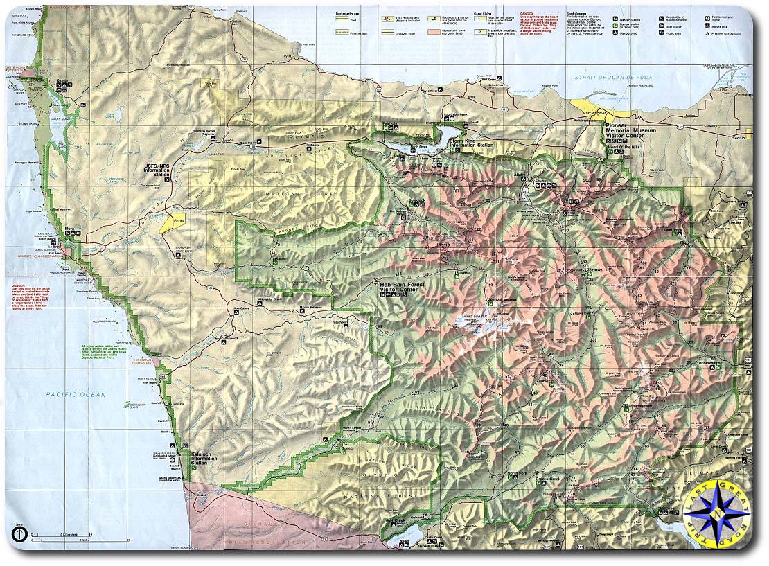
Turns out the Olympic Mountain Range is the wettest place in the lower 48 states… If you live in northwest you may think your back yard is the wettest place on earth this year but really the Olympics are it.
It also turns out that there are forest and old logging road encircling the majority of the mountain range. While not the gnarly boulder filled “roads” of Rubicon, the back roads of the Olympics offer seclusion in one of the most beautiful places in the northwest.
At just under 8,000 feet high, Mount Olympus is the big boy in the range which includes Mt. Deception, Constance, The Brothers, Warrior, Eleanor and a host of others. The range is filled with rain forest, beach, alpine meadows, rain shadows, clear cuts and some of the world’s largest trees.
This off-road adventure is not going to be about raising our testosterone level with gnarly terrain or testing the limits of our suspension. This adventure is about getting back in the saddle, connecting with the soul of the open road and freeing the demons in our head through quiet reflection alone in the middle of nowhere.
We’ve printed the maps and loaded 500 miles of GPS way points. Now to finish up a little rig maintenance and wait for the sun to warm up the trail… or at least the rain to stop for a bit. We haven’t figured it all out but looks like we have a plan… And a good plan today is better than a perfect plan a year from now.